Térképek.net – Online world atlas
Continent maps, country maps, regional map, geographical maps, travel maps, relief maps,
political maps. |
WorldAtlasz.com. Rich collection of maps, flags, geographical facts, data. Map list. Geographical superlatives – the highest, the biggest, the smallest,
the deepest, the oldest... |

Infoplease Atlas.
Map library, country information, statistical
information of the world. |

THEODORA’S MAP.
Free to download maps, facts, data. |
Online World Atlas
Gamequarium Educational Portal. |

Microsoft Encarta World Atlas |

National Geographic Xpeditions’s map pages.
Free to download; provides excellent contour
and country maps. |

Altapedia World Maps On Line.
Colour relief and political maps, information,
data, statistics of the world’s coutries. |
World Atlas |

Digital maps of the world |

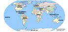
Maps of World.
This website offers maps - in excellent resolution –
of different countries, continents and cities. |
Holt, Rinehart, & Winston webatlas |

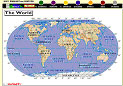
National Atlas
The publication contains more than 50 printable
maps of North-America. |

GlobeXplorer digital atlas |